Beleriand was the region of north-western Middle-earth during the First Age. Originally, the name belonged only to the area around the Bay of Balar, but in time the name was applied to the entire land.
Relative location to Eriador and within Middle-earth
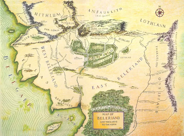
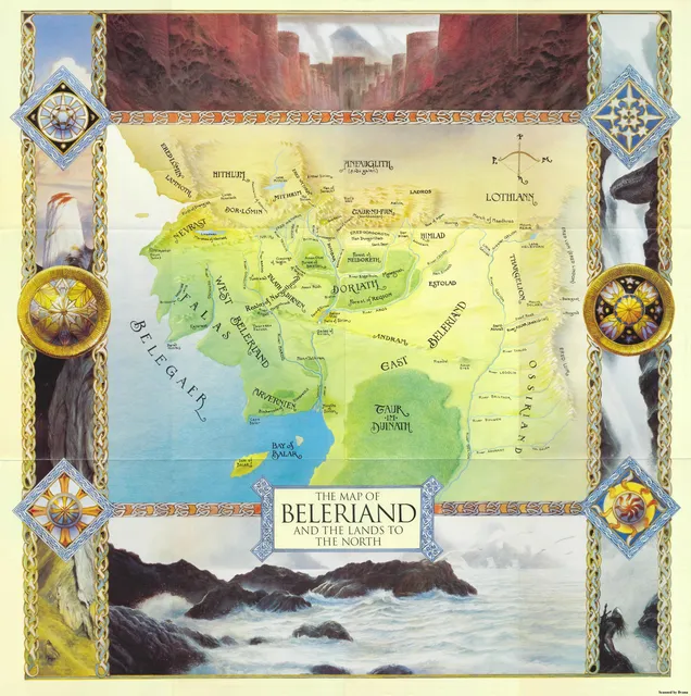
The map of Beleriand as published in The Silmarillion (1977) shows only a portion of the region, with few common points to the better-known Third Age Westlands maps of The Lord of the Rings; the only explicit common references are the Blue Mountains, which formed the boundary between Beleriand and Eriador, and the information that in the Third Age, Lindon was part of Ossiriand that survived Beleriand's destruction at the end of the First Age.
In 1979, Charles Noad made an attempt to reconstruct a general map of Beleriand and Eriador. Using only the few distance indications from the text of The Silmarillion, Noad's very early attempt is remarkable as it proves very accurate despite being published before Unfinished Tales (where the island of Himling was first depicted, with Tol Fuin mentioned westwards) and The History of Middle-earth.
In 1989, Ronald E. Kyrmse independently proposed his own map reconstruction, aligning the isle of Himling with the hill of Himring. Kyrmse also identified Dolmed on the early map of Beleriand as being the same as a mountain on the Unfinished Tales map (depicted slightly apart of the mountain range and north of the wooden area in Forlindon), proving that Dolmed still existed in the Third Age (being too far north from the Gulf of Lune to have been destroyed). He might therefore have been the first to discover that Dolmed survived the destruction of Beleriand at the end of the First Age.
In 1991, Karen Wynn Fonstad faced the same problems when she attempted to make a world-map of Arda. She found a solution by combining an early map for The Lord of the Rings (published in The Treason of Isengard) and an early map for the Silmarillion (published in The Lost Road and Other Writings), both being prototypes for the published maps by Christopher Tolkien. She aligned Tol Fuin with Taur-nu-Fuin and Himling with Himring and filled the rest of the outline with some inspiration from the only world-map by Tolkien. She brought the coast near that of Belfalas, continued the course of Gelion to the south-west, extended the south-western tip to emphasize the Bay of Balar, and assumed that area as forested, a continuation of Taur-im-Duinath. While the Iron Mountains do not appear in the canonical map, Fonstad drew them as a continuation to her imagined range of Iron Hills—Grey Mountains—Mountains of Angmar.
In the early 1990s, Didier Willis independently made the same attempt using the map from Unfinished Tales that shows Himling; the second map of Beleriand, which was published in The War of the Jewels and indicates distances; and the draft map of the lands east of the Blue Mountains published in The Treason of Isengard, which also indicates distances. Quite similar to Noad and Kymrse's earlier attempts, Willis' interpretation shows a slightly smaller Beleriand than Fonstad's and places the First Age Bay of Balar closer to the Third Age Gulf of Lune. Not knowing Kyrmse's earlier interpretation, Willis also independently recognized Dolmed on the early map of Beleriand and criticized Fonstad and Robert Foster who suggested the opposite.
In 2021, a manuscript from c. 1959 was published posthumously in The Nature of Middle-earth, in which Tolkien considers Beleriand to be about 550 miles broad from Eglarest to the Blue Mountains. When we equate this new found distance scale for Beleriand with the already known distance scale for the late Third Age Middle-earth (which appears in the map itself), both the Blue Mountains and Tol Himling and Himring are perfectly aligned, which means this is most likely the aproximate size and location of Beleriand when compared to the late Third Age Middle-earth (which is also a bit smaller than Fonstad's recreation).
Geography
In the First Age, Beleriand was among the westernmost lands of Middle-earth. Beleriand had a long western shoreline with the Great Sea Belegaer, including the Bay of Balar in its south-west. The Ered Luin (Blue Mountains) formed the eastern border of Beleriand, separating it from Eriador. To the south, Beleriand "had no sure boundaries; for there were pathless forests in those days between the unpeopled shores and the lower waters of [the river] Gelion." North of Beleriand were the highland regions of Hithlum, Dorthonion, and Lothlann. Some people considered the land of Nevrast to be part of Beleriand, while others considered it part of Hithlum. Beleriand stretched about 550 miles broad from Eglarest on its western shore to the Blue Mountains in the east.
The River Sirion, the chief river of Beleriand, running north to south, divided it into West Beleriand and East Beleriand. Crossing it east to west was a series of hills and a sudden drop in elevation known as Andram, the Long Wall. (The river sank into the ground at the Fens of Sirion, and re-emerged below the Andram at the Gates of Sirion.) To the east of the Long Wall, was the River Gelion and its six tributaries draining the Ered Luin, in Ossiriand or the Land of Seven Rivers. The River Brithon and the River Nenning were the two lesser rivers of the western land of Falas.
By F.A. 587, Beleriand was mostly destroyed and submerged under the sea from the War of Wrath of the Valar against Morgoth. Only a small section of East Beleriand remained, and was known as Lindon.
In addition, fulfilling a prophecy, the graves of Túrin Turambar and Morwen survived as the island Tol Morwen. Likewise part of Dorthonion became Tol Fuin, and the Hill of Himring became the island of Himling. All of these together were also mentioned as the Western Isles.
Regions and kingdoms of Beleriand:
- Arvernien
- Forest of Brethil
- Dimbar
- Doriath
- Estolad
- Falas
- Himlad
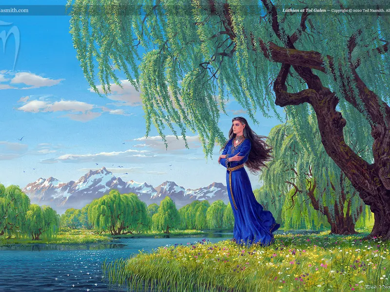
- Nan-tathren (Land of Willows)
- Talath Dirnen (Guarded Plain)
- Taur-en-Faroth (Forest of the Hunters)
- Taur-im-Duinath
- Thargelion
- Ossiriand or Lindon
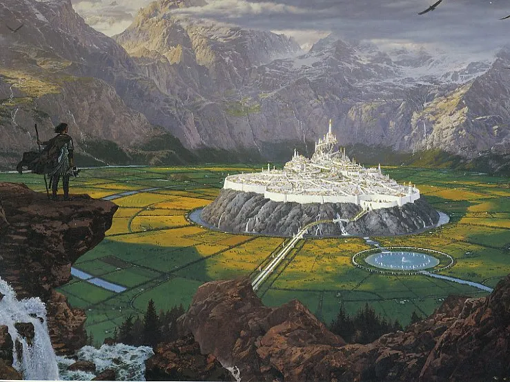
Cities of Beleriand:


